

4 minutes of readingJul 13, 2026 08:22 pm IST
By Subhosree Modak


The India Meteorological Department has stepped up its warnings by issuing a critical red alert for sub-Himalayan West Bengal due to an active monsoon trough and a high-altitude cyclonic circulation drawing massive moisture from the Bay of Bengal. Widespread light to moderate rain and showers are covering the entire region, driven by heavy rainfall. In the last 24 hours, Hasimara recorded a staggering 24cm of rain and up to 19cm in Buxaduar and Dima Tea Estate, triggering strict operational alerts for downstream areas. The Met warns that these intense conditions will keep water systems highly volatile for the next 48 hours while the monsoon remains active.
Kolkata is currently under heavy rain warnings as a heavy monsoon impacts urban areas, despite recording 0mm of rain till midday on July 13. An immediate orange warning has been issued for Kolkata along with northern 24 Parganas, Howrah, Nadia and Hooghly districts as severe convective clouds trigger moderate thunderstorms, lightning and intense spells of rain with wind gusts reaching 30-40 kmph over the next 24 hours. A generally cloudy sky dominates the city with an expected maximum temperature of around 31 degrees Celsius and a minimum temperature close to 26 degrees Celsius. High humidity, which will peak at 98 percent and drop to just 84 percent, will maintain stifling conditions as continued spells keep city streets under the constant threat of temporary waterlogging and traffic slowdowns until midweek.
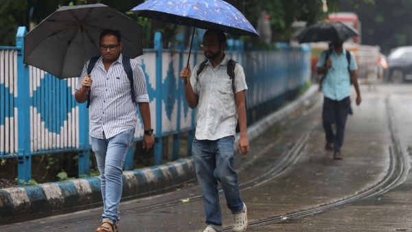

Very unstable atmospheric conditions are observed in the southern districts due to heavy rains falling over the plains. At the same time, a yellow warning is active for Bankura and Paschim Bardhaman districts, where light to moderate thunderstorms, lightning and wind gusts of 30 to 40 km/h are affecting the region. The weather will become increasingly severe by July 15 and 16 as heavy downpours are expected to combine with powerful gusty winds reaching speeds of 40 to 50 km/h in coastal areas and 30 to 40 km/h in the remaining interior districts.
The northern terrain is facing the brunt of the weather system, highlighted by an immediate red alert for Jalpaiguri and Alipurduar districts due to projections of extremely heavy rainfall exceeding 20cm on July 13.

At the same time, orange and red alerts have been issued for Darjeeling, Kalimpong and Cooch Behar for heavy to very heavy rain of between 7 and 20 cm, while up to 11 cm of rain is expected in Dinajpur districts. This intense deluge is expected to repeat itself and rain continuously until July 19, keeping mountainous terrain exceptionally prone to sudden environmental disturbances.
The meteorological department has highlighted serious impacts, including the possibility of landslides in the hilly areas of Darjeeling and Kalimpong; spikes in river water levels at Teesta, Torsa, Jaldhaka and Raidak; and heavy traffic congestion due to low visibility. The public is strictly advised to take shelter in safe places during lightning strikes, avoid staying near electric poles or trees and stay away from open fields and water bodies to avoid damage to life, standing crops and horticulture.
Story continues below this ad.
Furthermore, fishermen are explicitly warned not to venture into the sea along and off the coast of West Bengal from July 15 to 17 due to stormy sea conditions with gusts of up to 55 kmph.
The writer is an intern at The Indian Express office in Kolkata.